


News archive
Groundwater and Landslides: On the Road in Baja California
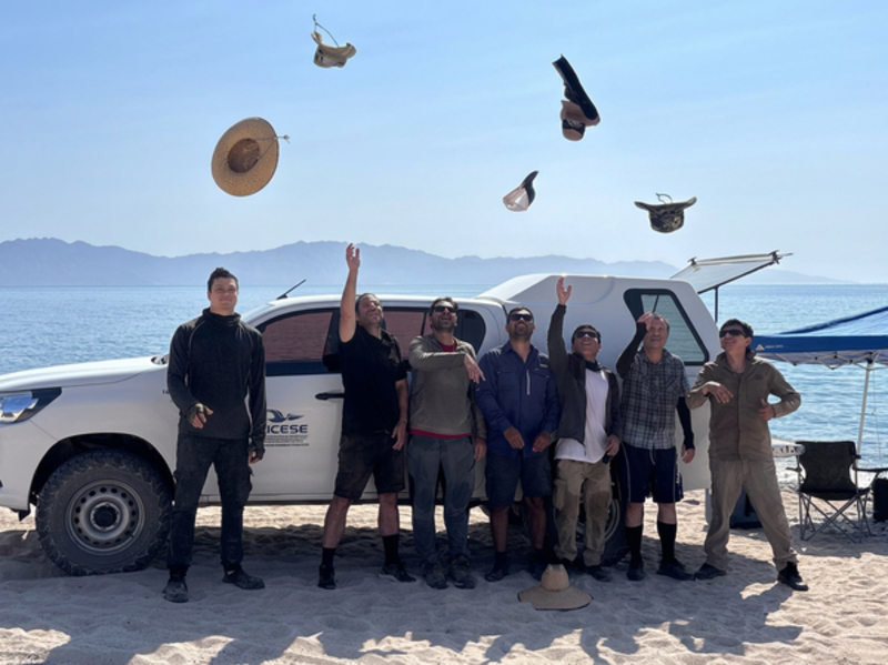
How does groundwater influence the risk of landslides? And how does seawater infiltrate coastal aquifers? In two field campaigns, researchers from LIAG, together with partners from Mexico and Germany, investigated the subsurface of Mexico’s Baja California Peninsula. The focus was on protecting limited groundwater resources and researching landslides. During the campaign, LIAG’s new sTEM measurement system was also successfully deployed in the field for the first time.
Science meets fiction: LIAG advises Daniele Palu on new North Sea crime novel
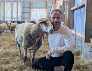
The new crime novel Marconi und die schweigenden Lämmer by Daniele Palu (publication date: 17 April 2026, Rowohlt Taschenbuch Verlag) shows that the North Sea coast is shaped not only by harsh winds, but also by complex processes deep underground. To portray the natural characteristics of the region around St Peter-Ording as authentically as possible, the true-crime expert and journalist sought scientific support from the LIAG Institute for Applied Geophysics (LIAG) in Hanover. This is because geophysics can help to investigate processes taking place beneath the surface.
Record drilling under Ross Ice Shelf: longest sediment core offers new clues to West Antarctic Ice Sheet future
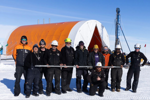
An international team of researchers has drilled the longest sediment core (228 m) to date under the Ross Ice Shelf in West Antarctica – some 700 kilometers away from the nearest research station. The samples obtained will provide insights into times when the West Antarctic Ice Sheet melted during the last 23 million years, covering periods when the Earth was warmer and richer in CO2 than it is today. The West Antarctic Ice Sheet contains enough ice to raise global sea levels by up to five meters. Several German institutes are involved in the SWAIS2C project, and a German scientist was present during the drilling in the field.
Research Team Develops New Geophysical Exploration Strategies for Raw Materials in Germany
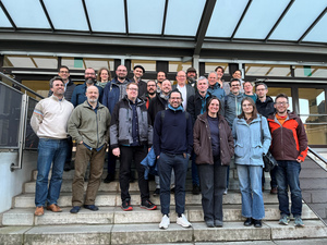
Demand for strategic raw materials in Germany is increasing significantly. In the new joint research project DESMEX-MinD, researchers from the LIAG Institute for Applied Geophysics (LIAG, Hanover), together with the Universities of Münster and Freiberg, the Leibniz Institute of Photonic Technology (Leibniz-IPHT, Jena), the Federal Institute for Geosciences and Natural Resources (BGR, Hanover), the State Authority for Mining, Energy and Geology (LBEG, Hanover), and industrial partners, are further developing innovative technologies and integrated approaches for the exploration of ore deposits. The project focuses on the mining regions of the Ore Mountains and the Upper Harz.
17th North German Geothermal Conference in Hannover: Future prospects for deep geothermal energy use
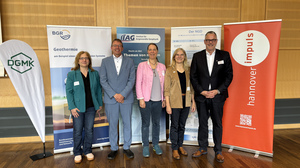
The 17th North German Geothermal Conference brought together experts from science, industry and municipalities at the Geozentrum Hannover. Geothermal energy is an indispensable component of Germany’s heating transition. But how can geothermal energy from greater depths, in particular, be used even more effectively for local supply? Around 150 experts addressed this question over two days at the 17th North German Geothermal Conference at the Geozentrum Hannover.
Third research colloquium strengthens geoscientific exchange in Hanover

Creating new momentum in the geosciences: Once again, the now third research colloquium of the FZ:GEO Research Centre at Leibniz University Hannover (LUH), together with its cooperation partners LIAG Institute for Applied Geophysics, the Federal Institute for Geosciences and Natural Resources (BGR) and the State Authority for Mining, Energy and Geology (LBEG), demonstrated on 14 April 2026 just how important close networking within the geosciences is.
Günther-Bock Prize: German Geophysical Society honours Dr Wiebke Mörbe

At its 86th Annual Meeting in Münster, the German Geophysical Society (DGG) honoured Dr Wiebke Mörbe with the Günther-Bock Prize. The award recognises her 2024 publication on large-scale three-dimensional inversion of semi-airborne electromagnetic data, highlighting its relevance for graphite exploration in Germany and thus for securing critical raw materials in the context of the energy transition.
Charged with Discovery: Heisenberg Research Group for Luminescence Dating and Data Science joins the LIAG Institute for Applied Geophysics
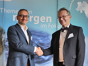
With the start of 2026, Dr Sebastian Kreutzer and his research group, funded by the German Research Foundation (DFG) in the Heisenberg Programme, will join the LIAG Institute for Applied Geophysics (LIAG). With its expertise in luminescence-based dating methods and geodata science, the group will strengthen geophysical research at the LIAG by advancing dating methods and data-driven approaches.
SeeKaquA performed major field campaign with drone-based geophysical measurement and hydrogeological sampling

The SeeKaquA project team has successfully completed its first milestone: a joint geophysical survey and hydrogeological sampling campaign in the Cuvelai–Etosha Basin (CEB) in the western Basin of the Kalahari in Namibia. Fieldwork took place in August/September 2025 to explore deep freshwater resources, investigate transition zones from fresh to saline water, and study perched aquifer systems at multiple demonstration sites around the town of Okongo.
Field surveys for 3D seismic measurements in the GeoMetEr research project completed

The LIAG Institute for Applied Geophysics has completed extensive seismic fieldwork for the GeoMetEr research project in the municipality association of Harsefeld. Following 2D profiles acquired in spring and an area-wide 3D survey campaign in autumn, the datasets are now entering the processing and interpretation phase. In October, additional airborne geophysical measurements were carried out using a helicopter survey. GeoMetEr aims to further develop geophysical measurement and data processing methods so that geological structures in the subsurface can be imaged with higher resolution and greater reliability in the future.
Geothermal Booster: First nationwide standardised map shows the potential for Geothermal Energy use in Germany
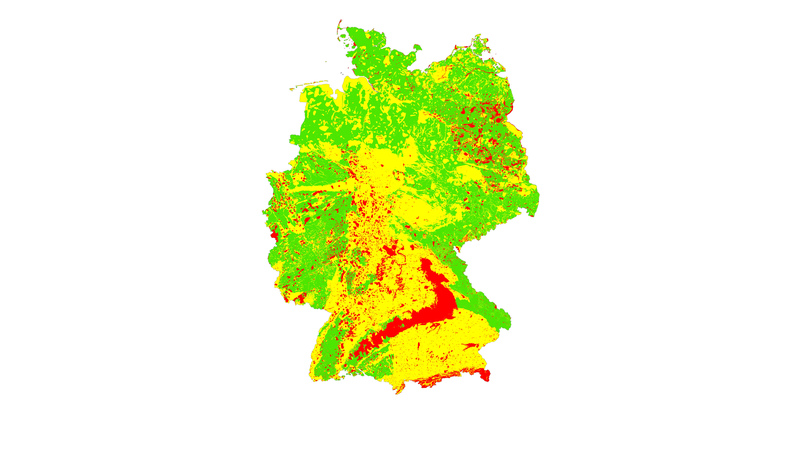
A milestone on the path to a climate-neutral heat supply: For the first time, a nationwide standardised geothermal map shows where the use of shallow geothermal energy via ground source heat pumps is possible – and where it is not. The interactive map was developed within the research project WärmeGut, led by the LIAG in Hannover in cooperation with the University of Göttingen (UGOE) and geoENERGIE Konzept GmbH from Freiberg, in collaboration with all 16 geological survey services of Germany.

New paper on dating fault activity with OSL and ESR in the Alps
New publication on dating major earthquakes in the Alps: Using two independent dating methods, researchers from the LIAG Institute for Applied Geophysics (LIAG) and Friedrich Schiller University Jena show that major fault systems in the Eastern Alps were seismically active during the Pleistocene. The study was published open access in Tectonics and was featured as an Editor’s Highlight in AGU’s Eos magazine.

Drilling into rock layers in Pattensen that are more than 200 million years old: LIAG researchers take measurements in the borehole.
Schulenburg near Pattensen (Hanover region) is known to be located on the Leine River. However, it is less well known that around 200 million years ago it was located on or in the sea, which is the subject of a geological investigation currently being carried out by the State Office for Mining, Energy, and Geology (LBEG). A borehole is to be drilled to a depth of 350 meters. Part of the borehole geophysics is being carried out by LIAG researchers.

LIAG-Forum 2025: In dialogue for excellent research
At the LIAG Forum, more than 70 participants discussed the institute’s research topics and structural orientation. The two-day event combined talks on LIAG’s overarching vision and research priorities with external guest inputs, concrete project examples, and working groups on cross-cutting themes. The aim was to take stock and gather feedback in order to identify priority fields for short- and medium-term action.

Start of the November of Science: LIAG participating as a partner
From 5 to 23 November 2025, Hannover’s universities, research institutions and education organisations invite the public to experiments, talks, discussions and exhibitions under the motto #knowember. More than 100 events can be found online at www.hannover.de/knowember. LIAG is a partner of Initiative Wissenschaft Hannover: at the public opening event on 5 November, researchers will be interviewed at Herrenhausen Palace in Hannover about their stay in Antarctica. On 7 and 13 November 2025, LIAG researchers will take visitors on a research expedition to Antarctica and to the Kalahari.
Development of geophysical measurement methods: Research team resumes measurements in the district of Stade
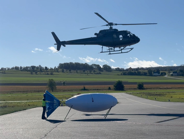
In October and November 2025, a research team from LIAG, the University of Münster, the Leibniz Institute of Photonic Technology e.V. and Supracon AG will conduct geophysical measurement flights with a helicopter and further measurements with vibration trucks and drones in the municipality of Harsefeld in the district of Stade. The measurements are part of the GeoMetEr research project. The aim is to develop geophysical measurement and evaluation methods in order to be able to map the geology underground in high resolution. The measurement area focuses on the overburden above salt domes. The Federal Company for Final Storage is funding the research – but only in areas that are excluded as final storage sites.
Unique global measuring infrastructure beneath Spiekeroog

The German Research Foundation is funding the DynaDeep project with around five million euros for another four years. The research group is investigating the transition zone between groundwater aquifers and the sea at high-energy beaches. Much of the research is taking place on Spiekeroog, with further measurements planned in France and Belgium. Researchers at LIAG observe the freshwater and saltwater zones there.
Natural hydrogen: Final HyAfrica meeting concludes with policy recommendations

The final project meeting of HyAfrica took place in July 2025 at the University of Évora, Portugal. Over a period of three years, the HyAfrica research consortium investigated the availability and potential use of white hydrogen in four African regions.
Sea level rise after the last ice age: more knowledge (Kopie 1)

New geological data has given more insight into the rate and magnitude of global sea level rise following the last ice age, about 11,700 years ago. This information is of great importance to understand the impact global warming has had on the ice caps and on sea level rise. The findings have been published in the scientific journal Nature by researchers from Deltares, LIAG, BGR, Utrecht University, TNO Netherlands Geological Service, Delft University of Technology, the Netherlands Institute for Sea Research (NIOZ), University of Leeds, University of Sheffield, University of Amsterdam.
The geochronology laboratory shines in new splendour

Comprehensive insights into the development of the Earth: Following a renovation phase, the modern measuring instruments for research in the geochronology laboratory are now available centrally at the LIAG in the Geozentrum Hannover.
Near-surface geothermal energy: Further maps published in GeotIS

The research project WärmeGut, led by LIAG, has published further easy-to-understand overview maps based on a traffic light system for the installation potential of geothermal probes in the Geothermal Information System GeotIS. Traffic light maps have now been published for the federal states of Lower Saxony, Hamburg, Bremen, Mecklenburg-Western Pomerania, Schleswig-Holstein and Thuringia.
Natural hydrogen: research for sustainable energy through white hydrogen

One of the first research initiatives dedicated to these questions is the pioneering HyAfrica project. The discovery of natural hydrogen deposits in Africa happened rather by chance: during construction work, evidence of hydrogen was discovered at depth. Initial investigations indicated that the quantity could be sufficient to supply entire communities with energy - an opportunity for sustainable energy utilisation.
60 pupils at the Geozentrum Hanover
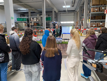
The ‘Future Day 2025’ at the Geozentrum Hannover was fully booked. 60 pupils attended today's ‘Girls'Day, Boys'Day 2025’ to find out what the three institutions at the Geozentrum - the Federal Institute for Geosciences and Natural Resources, the State Office for Mining, Energy and Geology and the LIAG - have to offer in terms of career prospects.
Millions in funding for the energy transition
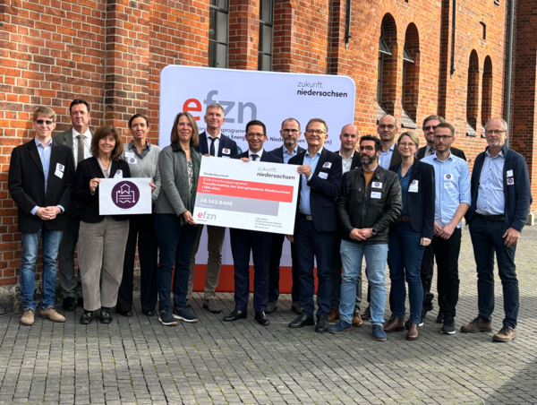
Research for a climate-neutral future: The funding program zukunft.niedersachsen supports the new research program “Transformation of the Energy System of Lower Saxony” (TEN.efzn) of the Energy Research Center of Lower Saxony (EFZN) with 58.2 million euros. LIAG is represented in the Geoenergy Systems research platform.
International team launch second attempt to drill deep for Antarctic climate clues
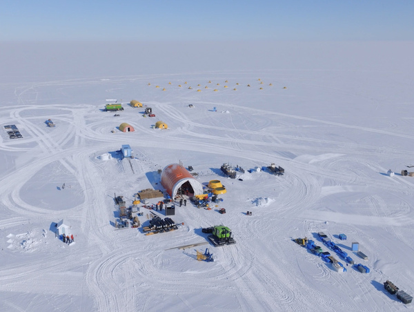
An ambitious mission is underway for critical geological records to forecast future sea-level rise, with the first team members departing on a 1128 km journey over ice to set up camp on the edge of the West Antarctic Ice Sheet. Project participants from Germany are the LIAG Institute for Applied Geophysics (LIAG, Hanover, on-ice), the Federal Institute for Geosciences and Natural Resources (BGR, Hanover), the Alfred Wegener Institute (AWI, Bremerhaven) and the Kiel University (CAU, Kiel).
International research team starts search for groundwater in the Kalahari
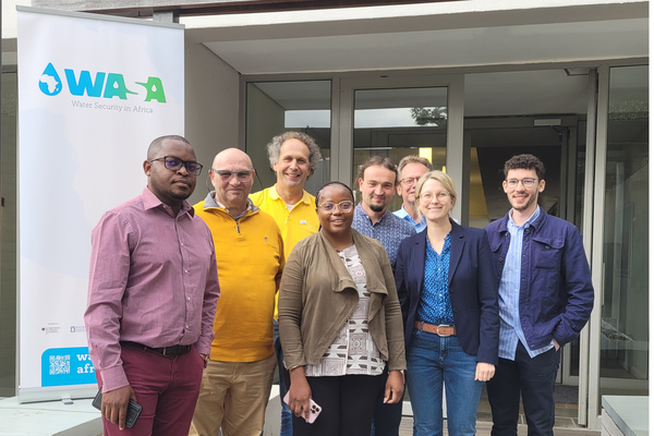
Southern Africa is one of the areas of the world most affected by drought. In the SeeKaquA project, an international research team led by the LIAG Institute for Applied Geophysics (LIAG) aims to detect deep groundwater resources in the Kalahari using state-of-the-art drone-based electromagnetics. The German-African project, in which the University of Namibia, the University of Zambia, the SADC Groundwater Management Institute, the Federal Institute for Geosciences and Natural Resources (BGR) and terratec Geophysical Services are also involved, is being funded by the Federal Ministry of Education and Research (BMBF) with 1.3 million €.
End of coal mining in Lusatia: excursion with students
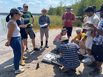
Students of geosciences at the Universities of Göttingen and Hanover and the Technical University of Berlin were given insights by LIAG into how lignite mining in Lusatia affects the groundwater and the surrounding area as well as the Spree and the ecosystem of the Spreewald. After the end of lignite mining in the Lusatia region, it is important to observe the area and its changes using geophysical measurement techniques and to develop sustainable solution strategies for the use of the area after the end of mining activities.
Read more (German)
LIAG leads project for increased water security in South Africa
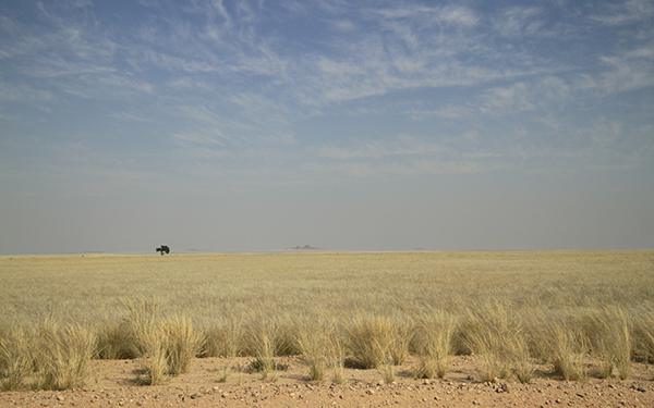
The German Federal Ministry of Education and Research is funding the SeeKaquA project for sustainable water resource management as part of the WASA programme. The aim is to locate the deeper groundwater aquifers in the Kalahari, Africa, using advanced semi-airborne electromagnetic methods with drones. In addition to LIAG, the German Federal Institute for Geosciences and Natural Resources and terratec geophysical services GmbH & Co. KG and, in Africa, universities in Namibia and Zambia as well as the SADC Groundwater Management Institute are involved. The first partner meeting and public kick-off will take place in South Africa at the end of September.
New maps for the installation of geothermal probes published for Hamburg and Lower Saxony

The WärmeGut research project aims to create a uniform nationwide overview of near-surface geothermal energy in the LIAG's geothermal information system “GeotIS”. For this purpose, so-called traffic light maps are created which show where geothermal probes can be used. With Mecklenburg-Vorpommern, maps for three federal states are now online.
Meeting of the GeoMetEr research group for the development of geophysical measurement methods
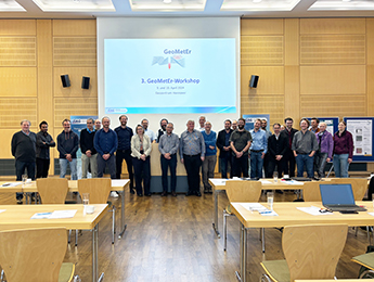
Intensive workshop within the GeoMetEr research project to develop geophysical measurement methods for the non-destructive exploration of the subsurface: Around 30 researchers discussed possible geophysical airborne methods, seismic methods and borehole measurements at LIAG on 9 and 10 April. LIAG is the scientific coordinator of the project, which is funded by the Federal Company for Final Disposal.
Logo-Refresh: LIAG Institute for Applied Geophysics
In future, we will operate under our own LIAG brand as the "LIAG Institute for Applied Geophysics"! With currently 40 ongoing research projects, the doubling of third-party funding (especially DFG), our own science-oriented administration and the bundling of our methods, we will continue to research the topics of groundwater systems, geohazards and georeservoirs as energy sources and energy storage.
Near-surface geothermal energy in Germany: first traffic light map in GeotIS shows potential for geothermal probes
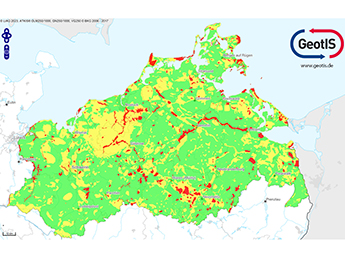
Wo gibt es Erstinformationen zu den Nutzungspotenzialen und zum Einstieg in die Geothermie? Forschende des LIAG und der Georg-August-Universität Göttingen (UGOE) stellen im Geothermischen Informationssystem GeotIS mögliche geothermische Ressourcen dar und zeigen mit Überblickkarten nach Ampelsystem auf, wo Erdwärmesonden zum Heizen und Kühlen von Gebäuden eingebaut werden können.
EU Fund Communication Officers visit Hanover Geo Centre: Presentation of the Interreg project Blue Transition
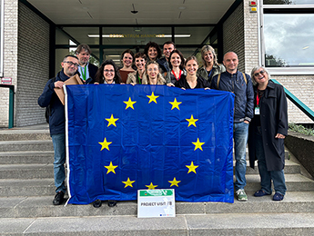
Using EU research projects to promote cooperation on solution strategies and strengthen communication on research results across national borders: During an excursion of the INFORM exchange forum for the communication officers of various EU funds organised by the European Commission and the European Ministry of Lower Saxony, the Interreg project Blue Transition on the North Sea region in climate change led by LIAG was presented at the Geozentrum Hannover.
Future Day 2024: 65 pupils at the Hanover Geocentre
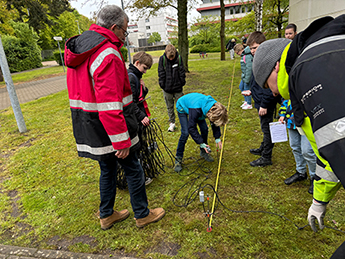
65 pupils came to the Geocentre in Hanover for ‘Girls'Day, Boys'Day 2024’ to learn about careers in the geosciences. On the so-called Future Day, the Federal Institute for Geosciences and Natural Resources (BGR), the State Office for Mining, Energy and Geology (LBEG) and the LIAG presented their activities in areas such as geothermal energy, groundwater and final disposal.
DPMA grants LIAG a patent for a measuring cell for determining complex electrical properties of rocks
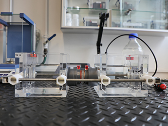
Researchers in the field of rock physics and borehole geophysics at LIAG have developed a measuring cell for laboratory measurements using the spectral induced polarisation (SIP) method to investigate complex electrical properties of natural solid and unconsolidated rocks with significantly improved quality of results.
Honours at the annual conference of the German Geophysical Society

Michael Grinat receives honorary membership of the German Geophysical Society, the Emil Wiechert Medal goes to long-standing research partner Prof Dr Andreas Weller from TU Clausthal.
Safety - Analysis of the Aller valley fault zone in Germany
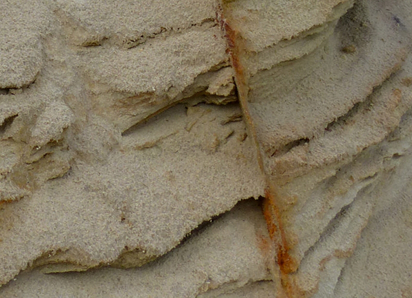
Studies are increasingly showing that fault systems in areas of slow deformation such as northern Europe can also cause strong earthquakes, even if they do not exhibit any seismicity. Faults that are millions of years old in particular surprise us with relatively unexpected earthquakes. In the new DFG project SAFETY, the near-surface fault structure of the Allertal fault system near Hämelhausen and Lehringen in Lower Saxony is being analyzed using shear wave seismics, which have been further developed at LIAG, and georadar. The Aller fault zone is one of the longest old faults in northern Germany.
Temperature overview in the geothermal portal GeotIS (Kopie 1)
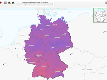
Updated start page: With a new temperature-depth controller, the temperatures and thus the potential for geothermal energy in various regions in Germany can now be viewed easily, user-friendly and individually on the main map. The new function was developed as part of the ArtemIS project.
LIAG celebrates 75 years of geophysics in Hanover
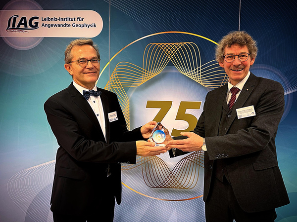
Researchers at LIAG and its predecessor institutions have been using applied geophysical methods to explore the near-surface and usable subsurface for 75 years and are constantly developing measurement and evaluation methods. Around 130 invited guests, including Lower Saxony's Environment Minister Christian Meyer and State Secretary in Lower Saxony's Ministry of Economic Affairs, Transport, Building and Digitalisation, Frank Doods, took part in the anniversary celebrations on 15 November 2023.
Researchers in the EU Blue Transition project meet politicians and stakeholders in the Netherlands
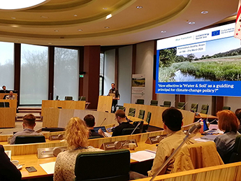
Partner meeting with policy week in the EU project Blue Transition (Interreg North Sea Programme) in Assen, Denmark, end of March! The project partners, climate experts, policy makers and stakeholder representatives could discuss the different sustainable strategies of the 16 pilots in six countries on how we can deal with the impacts of climate change in terms of groundwater and soil management in the North Sea region.
Read more
Climate and landscape development in the Alpine region

LIAG and its partners are conducting seismic measurements in a glacial basin in the municipality of Schäftlarn (Munich district) as part of a research project affiliated with DOVE. In the course of the research, a combination of evaluation methods will be applied for the first time. The aim of the overall project is to reconstruct the climate and landscape development during the ice ages (from 2.6 million years ago until today) in the Alpine region.
TONIA: Nutrient management in agriculture
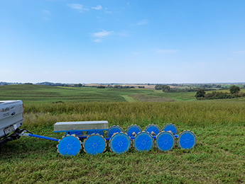
The aim of the joint project is to optimise nutrient management on arable soils. As the soil is very specific, the areas are measured geoelectrically. LIAG is responsible for analysing the geoelectric data. The conductivity maps are converted into 3D soil texture maps with the help of reference measurements.
LIAG and the University of Tübingen appoint Sumiko Tsukamoto as professor of Quaternary geochronology
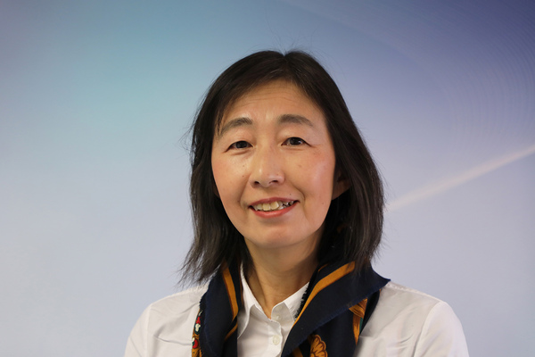
The LIAG and the Eberhard Karls University of Tübingen jointly appointed Sumiko Tsukamoto as Professor of Quaternary Geochronology in August. Using geophysical dating methods, the physicist researches the temporal developments in the Quaternary period - the youngest and at the same time shortest epoch in the history of the Earth, which has lasted for 2.6 million years. Starting in the upcoming winter semester, she will supervise both bachelor's and master's students at the University of Tübingen.
Read more
North Sea region in climate change: researchers meet for solution strategies in Denmark
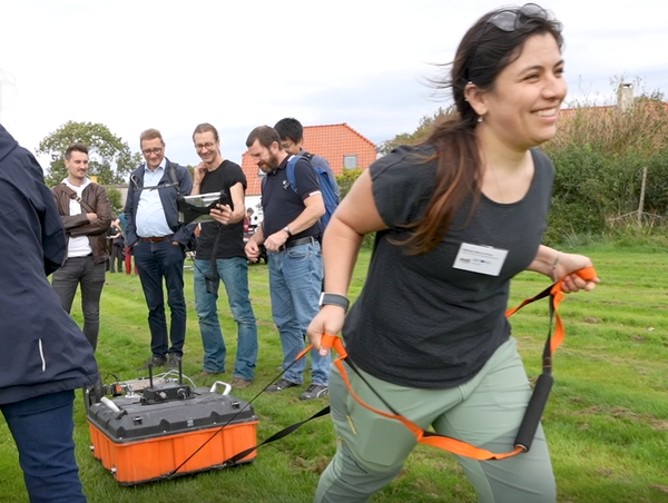
First partner meeting in the EU Interreg project Blue Transition in Denmark for sustainable groundwater and soil management. 60 participants from Denmark, the Netherlands, Sweden, Belgium, France and Germany attended the three-day meeting and visited one of the Danish pilot sites. A video offers exciting impressions.
Saarland participates in "WärmeGut" research project
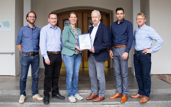
An effort that can only be achieved together: the omplementation of a nationwide uniform information system on the potential of near-surface geothermal energy for heat supply. To sign the association agreement, the project leader of LIAG, Prof. Dr. Inga Moeck, met with the head of the State Office for Environmental Protection and Occupational Safety (LUA) and other project participants of the State Geological Survey of Saarland.
Hanover's universities and research institutions open all doors again
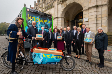
From November 1 to 19, 2023, Hanover's universities, research institutes and educational institutions once again invite you to numerous lectures, discussions, experiments and exhibitions under the motto #knowember. The November of Science is a project of the Initiative Wissenschaft Hannover. The LIAG is a partner of this initiative and will host its 75th anniversary at the aufhof on November 15 and 16 with keynotes, panel discussions on socially relevant topics such as groundwater, energy sources and storage, and geohazards. Geophysical methods will be brought to life.
Optimised groundwater exploration
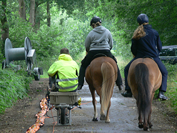
LIAG is coordinating the OGER project, which has been approved by the German Federal Foundation for the Environment. The development of an economically feasible workflow for hydrogeological exploration using geophysical methods should enable a reduction in cost-intensive drilling while at the same time gaining more information. A special focus lies on northern Germany.
First meeting of the new German working group Geomagnetics
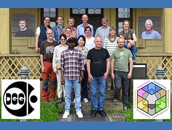
Research meeting at the LIAG site in Grubenhagen: The aim of the new working group of the German Geophysical Society is to bundle and further develop the heterogeneously distributed facilities and expertise in the fields of geo-, archaeo-, paleo-, mineral-, environmental- and biomagnetic research.
Fault-bounded deep geothermal reservoirs
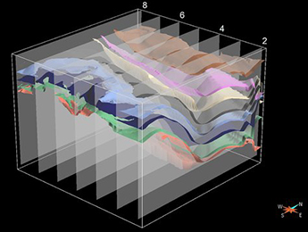
Exploring geothermal potential: In the new E4Geo project, researchers from LIAG, GFZ and TU Bergakademie Freiberg are developing basic principles for the use of fault-bounded, hydrothermal reservoirs in the Schönbrunn region. A 3-D forward model is being created at LIAG and a sensitivity study is being carried out to quantify uncertainties.
Geothermal Energy Day at the Geozentrum Hannover
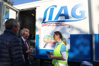
Is the use of geothermal energy worthwhile in Lower Saxony? At the Geothermal Energy Day at the Geozentrum Hannover, the LIAG showed how research can use geophysics and data processing to determine the potential. Lower Saxony's Secretary of State Frank Doods also obtained information on site from geothermal energy expert Inga Moeck.
Development of measurement methods for repository site selection
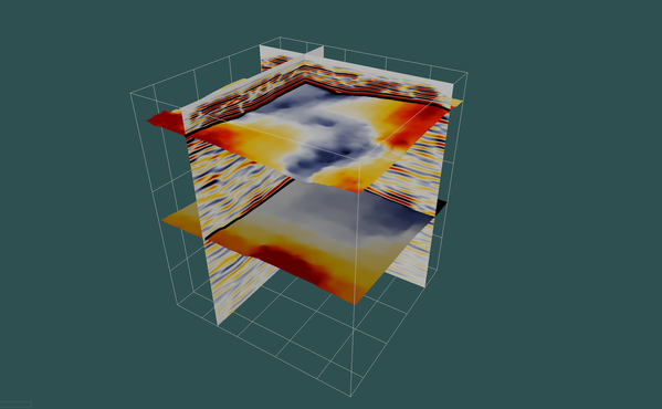
As part of a research contract from the Federal Company for Radioactive Waste Disposal, the LIAG is leading the scientific work in the "GeoMetEr" project with a total volume of 8.8 million euros.
WärmeGut research project: Innovations in GeotIS
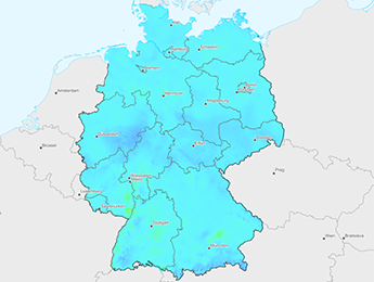
In a first interim result of the WärmeGut research project, LIAG's geothermal information system GeotIS was expanded to include up-to-date temperature maps and new functionalities for shallow and medium-depth geothermal energy.
TONIA: nutrition management in precision agriculture
The aim of the joint project is to optimise nutrient management on arable soils. Since the soil is very specific, the areas are measured geoelectrically. The LIAG is responsible for the evaluation of the geoelectrical data. The conductivity maps are converted into 3-D soil texture maps with the help of reference measurements.
Study identifies deficits for the accelerated expansion of deep geothermal energy
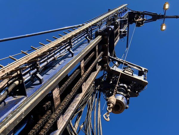
Where and under what aspects can there be bottlenecks that could hinder the rapid expansion of geothermal energy? In order to answer this scientific question, the LIAG, on the initiative and under the direction of Prof. Dr. Inga Moeck, has launched an institute-funded cross-impact study and carried it out together with the University of Göttingen.
Read more (German)
Blue Transition to secure groundwater resources
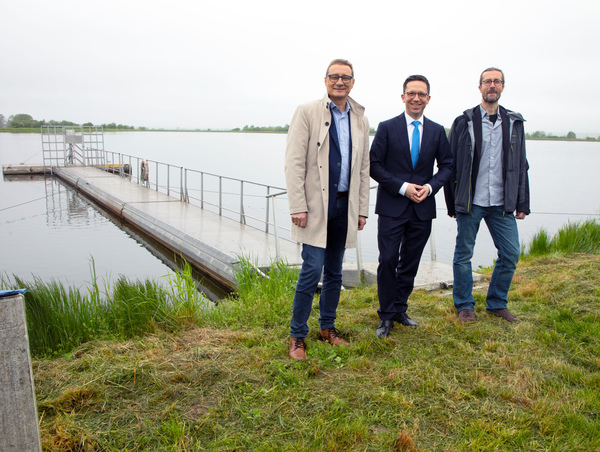
Lower Saxony's Science Minister Falko Mohrs visited pilot area "WaterFarmers" in the Interreg research project Blue Trantition to develop sustainable solutions for groundwater and soil management in the North Sea region.
Lower Saxony's heat turnaround picks up speed
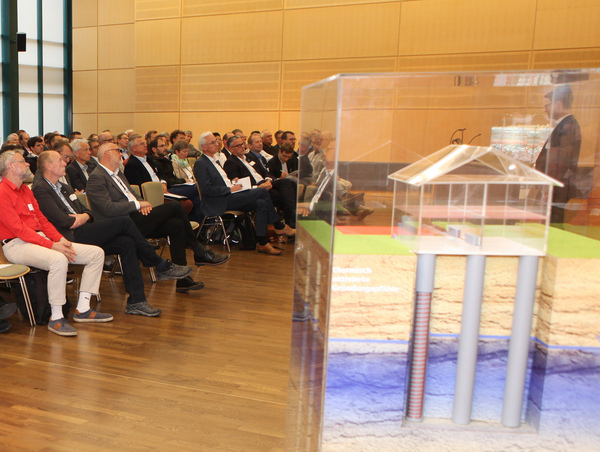
Hotspot Hannover: More than 160 experts take part in the 14th North German Geothermal Conference at the Geozentrum Hannover.
To the press release (German)
Temperature overview in the geothermal portal GeotIS
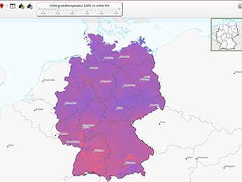
Updated home page: With a new temperature-depth controller, the temperatures and thus the potential for geothermal energy in a wide variety of regions in Germany can now be viewed easily, user-friendly and individually on the main map. The new function was developed as part of the ArtemIS project.
Future Day: 110 pupils at the Geozentrum Hannover
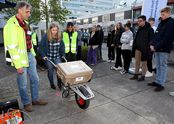
What do I want to be when I grow up? The answer to questions like these is made easier every year by the so-called Future Day. For today's "Girls'Day, Boys'Day 2023", 110 schoolchildren came to the Geozentrum in Hanover to get a glimpse of a very diverse professional world.
Solutions for the North Sea region during climate change - Kick-off of the Blue Transition research project
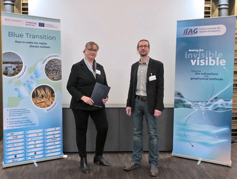
Starting signal for the development of solutions for sustainable groundwater and soil management in the North Sea region: More than 60 national and international researchers met for the kick-off of the joint project "Blue Transition", which is funded, among others, by the EU with several million euros. With many political guests, among others, the festive event in Hanover already provided an important platform for exchange.
Cooperation on geothermal potential in Ukraine
Partnership between the Institute of Renewable Energy of the National Academy of Sciences of Ukraine (IRE NASU) and LIAG: The research institutes will work together to explore geothermal energy in Ukraine from source to energy use and to support Ukraine in its climate protection goals through scientific results and advice. A geothermal information system will be established in Ukraine, based on the LIAG's Geothermal Information System GeotIS.
Geothermal energy for the heat transition: LIAG leads research project on data campaign
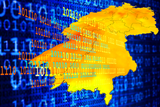
The BMWK is funding the major project "WärmeGut" led by the LIAG for research and data provision for a nationwide standardised database with accessible and processed information on local geothermal potential and mentions the goals specifically in a new key points paper for a geothermal campaign. For more than 15 years, the LIAG has already been regularly expanding the GeotIS geothermal portal, which is unique in Germany and provides a detailed overview of deep geothermal energy.
HyAfrica investigates natural hydrogen in Africa as an alternative energy source
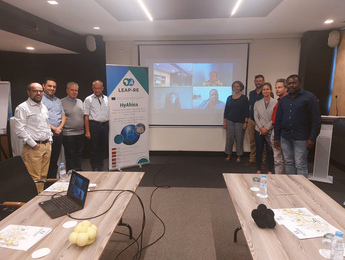
The HyAfrica project is exploring deposits of natural hydrogen in several African countries to provide alternative energy for local areas. The long-term joint research and innovation partnership between the European Union and the African Union in the field of renewable energy (LEAP-RE) is funding the project with a budget of almost one million euros. In Germany, the Fraunhofer IEE and the LIAG are significantly involved.
Rare earth elements in Sweden: The DESMEX research project contributes to the exploration of deeper deposits
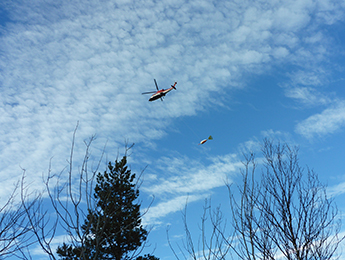
Extensive geoscientific exploration work is leading to the discovery of large quantities of rare earth elements in Kiruna, Sweden, where the company LKAB recently announced. The joint project DESMEX, in which LIAG was involved, also made a contribution. Follow-up projects are already underway.
Geoscientists discovered the climate history of the last 500,000 years of central Mexico
The effects of climate change on tropical regions are still poorly understood. However, they are among the most populated areas in the world. Researchers at the LIAG have now created both an age-depth model and a moisture distribution for the last 500,000 years from one of the oldest lakes in central Mexico, Lake Chalco. The results are clear: Central Mexico experienced recurrent dry periods related to the Earth's natural wobble.
The LIAG seminar starts with a new program

The LIAG's two-week lecture series begins on 22 March with a new programme on specialist insights into ongoing projects and geophysical method applications.
The LIAG at the DGG Annual Conference

With numerous formats, the LIAG presented itself with exciting research topics at the annual conference of the German Geophysical Society (DGG) from 7 to 10 March.
Applied geophysics: How does seismics actually work?

Research at LIAG simply explained: The seismic measuring instruments developed at the institute are used to gain knowledge about processes and structures as well as changes in the subsoil, which is difficult to access. This is particularly important for issues relating to groundwater and geohazards. But how exactly do we work with the method?
Neotectonic development of the Osning Lineament

A new DFG project enables research on near-surface faults at the Osning Lineament in northern Germany in the context of neotectonics - so far little is known about the reactivation of the fault. However, there have been several earthquakes in the past 400 years.
CO2 storage in climate change: LIAG comments on EU call

The EU Commission has asked for feedback on the topic "Climate change - restoring sustainable carbon cycles". In its commentary, the LIAG points out the possibilities of using geophysics to improve the understanding of CO2 storage. It recommends detailed studies in laboratory and field environments and a combination of soil, geochemical and geophysical methods to assess carbon uptake under diverse conditions and from laboratory to field scale.
#Knowember: LIAG with "Meet the Scientist" format on November of Science

"Meet the Scientist": LIAG researchers answer questions from the interested public on the topics "Earthquakes in focus" (4.11.) and "Drones as measuring platforms: Geophysical exploration" (8.11.) on November of Science in cooperation with FZ:GEO online. Participation is free of charge.
To the dates (presentations in German)
LIAG new member of the "Initiative Wissenschaft Hannover"

Meeting with Lord Mayor City of Hannover Belit Onay at the opening of the "November of Science" aka #knowember: The #LIAG is a new member of the "Initiative Wissenschaft Hannover"! With this cooperation, LIAG and its partners will strengthen the attractiveness and #internationalisation of Hannover as a science location.
DESMEX II: Exploration of mineral deposits (Kopie 4)

In the DESMEX II project, a helicopter with a flight probe will explore the geological subsurface in the western Harz region (north of Germany) at an altitude of about 70 metres as part of a geophysical measurement campaign starting on 23 August. In addition to its involvement in the ground measurements, the LIAG is also significantly involved in the development of a programme for complex data processing in order to make the structures in the subsurface visible in a 3-D model.
Climatically determined landscape development in warm periods

New piece of the puzzle for understanding changes in future natural systems: In the Lichtenberg project, the LIAG and partners researched landscape stability and development during the Eemian warm period about 120,000 years ago in the Wendland region of Hanover. The Eemian is climatically comparable to the forecasts for the 21st century.
Anthropocene urges joining the expertise

Leibniz institutions and LIAG launch novel research initiative: Scientists from a wide range of disciplines from Leibniz Association institutions are launching an initiative for "Integrated Earth System Research". Together with partners from Germany, Europe and other countries, they will investigate the current epoch of the Earth’s history, which is strongly influenced by humans, in a coordinated and interdisciplinary way as never before. The findings will point out both high-risk and safe development paths for politics, business and civil society.
Funding commitment NFDI4Earth Consortium

On the recommendation of the German Research Foundation (DFG), the Joint Science Conference (GWK) decided on 2 July to fund the National Research Data Infrastructure for Earth System Research (NFDI4Earth) consortium and nine other consortia. This concludes the second round of calls for proposals, in which 16 initiatives applied for funding. With the help of the National Research Data Infrastructure (NFDI), data from science and research is to be systematically made accessible, secured, made more widely available and networked internationally.
Read more (German)
New Global Network for Climate Reconstruction in Shallow Marine Areas

The newly established international network PRISMS investigates climate signals in shallow marine environments worldwide. The studies of sediments deposited in shallow marine waters and on shelves can provide information about Earth's climate dynamics and sea level changes. Besides partners from Canada, Taiwan and Switzerland, the LIAG with Christian Zeeden is one of the founding members.
_________________________________________
Rodderberg – powerful climate archive reveals itself to be a rare treasure

Ten years after drilling began, the crater of the Rodderberg volcano will soon reveal all its secrets about climate development: 14 international scientists from eight research institutions have combined their drill core analyses in the Rodderberg project coordinated by LIAG and the University of Bremen, creating a huge, high-quality pool of data. The first discovery: The Rodderberg is a rare "superposition".
_____________________________________________________
#LIAG goes Social Media!
The LIAG Institute for Applied Geophysics is now active on Facebook and Twitter in addition to the social networks LinkedIn and YouTube!
___________________________________________________
"Salinisation": Filming of the LIAG saline water monitoring system SAMOS with ZDF Terra Xpress

For a feature on salinisation in the programme Terra Xpress on ZDF, LIAG researchers were interviewed during their measurements using our saltwater monitoring system SAMOS. With the early warning system developed at LIAG, water suppliers can be supported sustainably and in the long term in water quantity management, thus protecting groundwater. The documentary is expected to be broadcast in September.
______________________________________________________________________
LIAG new on YouTube!

LIAG has its own YouTube channel for exciting and deeper insights into our research within Applied Geophysics. Subscribe now and stay up to date!
Go to the LIAG YouTube channel
_________________________________________________________________________________________
North German Geothermal Conference

Climate-friendly and reliable - this is how near-surface geothermal energy is proving itself in more and more practical examples for heating and cooling buildings. It is therefore high time to recognize its potential as a possible key to the heat transition and to use it even more intensively. On May 5 and 6, numerous experts from politics, companies, authorities and research discussed how this can be achieved at the North German Geothermal Conference organized by BGR, LBEG and LIAG.
__________________________________________________________
Climate evolution in the European Alpine region: International research project starts with drilling

How did the climate in the Alpine region change during the ice ages and how did it shape glaciers, flora and fauna over the millennia? The LIAG, in cooperation with the Albert Ludwig University in Freiburg and the State Office for Geology, Raw Materials and Mining in the Freiburg Regional Council (LGRB), is starting three research boreholes near Winterstettenstadt at the beginning of April. The boreholes, which are up to 160 meters deep, mark the start of the international project "DOVE - Drilling Overdeepened Alpine Valleys". This aims to reconstruct the spatial and temporal climate development during the ice ages over the past 2.6 million years in the entire Alpine region.
To press release (German, English in translation)
____________________________________________________
DFG funds better visualization of very active disorder in New Zealand

The German Research Foundation (DFG) is funding a potentially pioneering joint project between LIAG and LUH to visualize one of the most famous faults in New Zealand: The aim is to investigate and for the first time concretize the course of the "Hope Fault" on the South Island in New Zealand near Kaikoura from bedrock to loose sediment. Measurements are expected to start in early 2022.
More information (German)
____________________________________________________________________________________
Dynamic Underworld: DFG funds new DynaDeep research group with around 5 million euros

In the subsurface of wave-swept North Sea beaches, diverse processes take place about which little is known so far. This dynamic underworld, where salt and fresh water mix, is the focus of the new research group "Dynamics of the deep subsurface of high-energy beaches (DynaDeep)", in which LIAG is also involved. The research group, led by the University of Oldenburg, analyzes the biogeochemical processes and will assess their impact on coastal ecosystems and on material cycles - initially on a model basis on Spiekeroog.
Read more (in German)
________________________________________________________________________
"Meet the Geophysicst": LIAG doctoral student gives insights into her career start

From geosciences to geophysics – LIAG PhD student Katharina Leu has succeeded in starting her career after graduation. Since October 1, 2020, she is doing her PhD in Rock Physics & Borehole Geophysics and evaluating geophysical borehole measurements within the ICDP project "JET" (Integrated Understanding of the Early Jurassic Earth System and Timescale). In DGG's newsletter series "Meet the Geophysicist" she tells more about her career, her decisions and experiences before and during her studies and gives tips for the subsequent career entry.
Read more (German)
__________________________________________________________________________________________
The Cretaceous period in Lower Saxony: Geophysicists measure to reconstruct the conditions at that time in Rehburg

How can we imagine the Cretaceous period in Lower Saxony, Rehburg - how far exactly did the inland sea extend at that time and what did the coastal region look like where the dinosaurs lived? Geophysicists from LIAG are measuring the properties of the sediments in a 180-meter-deep borehole drilled by the State Office for Mining, Energy and Geology (LBEG) in Rehburg in the Nehrenbruch, near the Steinhuder Meer, in January to help answer these questions, among others.
____________________________________________________
Palaeoearthquakes in the eastern Alps: New dating methods allow age determination about the Periadriatic fault for the first time

According to the current state of research, the eastern Periadriatic Fault System (PAF), on the border between the Eastern and Southern Alps, shows barely any historical and instrumental earthquakes - although it is one of the most important tectonic features of the Alps. In this new project, the LIAG Institute for Applied Geophysics (LIAG) and the Friedrich Schiller University Jena are now using new dating methods, which for the first time will allow the most recent geological fault activities to be revealed.
Full press release
____________________________________________________________________________________
Geohazards: DFG funds research of Osning Lineament's neotectonic evolution

Neotectonic movements on faults can be a major hazard. In northern Germany, however, little is known about neotectonic activity, despite evidence of it. At the Osning Lineament on the southern edge of the Lower Saxony Basin, there have been ten earthquakes in the last 400 years, one in 1612 with particularly severe consequences for Bielefeld. The project aims to demonstrate the significance of near-surface faults in relation to neotectonic activity - and why the Osning Lineament in particular is unique.
Read more (German)
___________________________________________________________________________________________________________________________________
LIAG at virtual AGU Fall Meeting 2020

How will you “Shape the Future of Science?” The American Geophysical Union (AGU) asks this question at its world's largest geoscience conference. This year's conference will take place virtually from December 1 to 17 – LIAG is involved in the organization of a session on the topic "Astronomical forcing and Past Climate Cycles" (Dr. Christian Zeeden). LIAG researchers will also give various thematic presentations.
To the website (program only with registration)
___________________________________________________________________
Manfred Frechen to be Acting Director of LIAG

The LIAG Institute for Applied Geophysics (LIAG) officially appoints Prof. Dr. Manfred Frechen as acting director by resolution of its Governing Board. Prof. Dr. Gerald Gabriel takes over his previous position as deputy director. Both are currently in charge of the research areas "Geochronology" and "Seismics and Potential Methods" at the institute.
______________________________________________________________________________________________________
LIAG as guest at 'Leibniz in State Parliament'

‘Leibniz in State Parliament‘ takes place on 10 and 11 November 2020. This dialogue format enables researchers at Leibniz institutions in Lower Saxony to discuss current issues and challenges in research and policy with members of the state parliament and allows both groups to be apprised of new developments. As a guest institute, LIAG provides information on topics such as the status of groundwater using innovative, drone based geophysics with regard to drought, drought and salinization or geological hazards - because sinkholes and earthquakes also affect Lower Saxony.
________________________________________________________________
Wolfgang Helms Foundation Prize goes to former LIAG doctoral student

Dr. Sarah Hupfer receives the award of the Wolfgang Helms Foundation of the TU Clausthal for her dissertation on solution processes in carbonates! With her work she conducted important basic research for a better understanding of subrosion-related processes, such as sinkholes, and their risk assessment. She was supervised at LIAG by Dr. Matthias Halisch, at TU Clausthal by Prof. Dr. Andreas Weller and at TU Berlin by Prof. Dr. Sabine Kruschwitz.
_______________________________________________________________________________________________
Exploration of ore deposits in the Harz Mountains by new method

From September 22-30, a helicopter operated by the project partner BGR as part of the DESMEX II project flew in the Harz Mountains to explore the difficult to develop ore deposits by means of electromagnetic measurements. With the data LIAG will develope a new program system for very complex data processing and visualization in a 3-D model. Scientists at LIAG and WWU Münster have also fed heavy currents into the underground for the measurements and supplement the measurements from the air with ground stations. UAV flights are also planned in the project.
To project website
_______________________________________________________
The DGG celebrates its 100th anniversary

DGG presents its ground-breaking history of 100 years and takes a look into geophysical research fields for the upcoming years. LIAG is also visible.
__________________________________________________________
Experts support the LIAGInstitute for Applied Geophysics in defining its research direction

On the 7th and 8th September, the LIAG Institute for Applied Geophysics (LIAG) initiated a two-day workshop to discuss its future line of research with 11 external scientists who have a proven expertise in geoscientific topics and geophysics. The event was opened by Dr. Berend Lindner, State Secretary of the Lower Saxony Ministry for Economic Affairs, Labour, Transport and Digitalisation.
Read more
____________________________________________________________________________________________________________
LIAG and the geothermal industry in dialogue with the German Bundestag

Potentials of geothermal energy: Prof. Dr. Inga Moeck, line manager at LIAG, presented the current research project "mesoTherm" to interested guests from federal politics at the Parliamentary Evening of the German Geothermal Energy Association and the German Renewable Energy Federation. The joint project mesoTherm (University of Göttingen, GTN and LIAG) is linked to the project IW3, in which Hamburg Energie is implementing the integrated heat turnaround in Hamburg Wilhelmsburg. Together, these partner projects, funded by the German Federal Ministry of Economics and Technology, are making an important contribution to the energy turnaround in northern Germany.
To mesoTherm project
__________________________________
Start of first drone measurement flights

A new drone at the LIAG will in future simplify the exploration of underground structures and promote the large-scale collection of data for the investigation of groundwater systems. A new geophysical method is to be developed with which the institute can distinguish itself as a partner in the field of geophysics by using drones.
_____________________________________________________________________________________________________________________________
Christian Zeeden joins the editorial board of "Quaternary Geochronology“

Dr. Christian Zeeden is now part of the editorial board of "Quaternary Geochronology" - a prestigious international journal dedicated to publishing high quality articles on dating methods applicable to the Quaternary period. This is a prestigious opportunity for the LIAG scientist to advocate and constructively ensure best scientific practice.
View the Editorial Board
_______________________________________________________
First interactive e-learning on deep geothermal energy

Understanding deep geothermal energy: The LIAG Institute for Applied Geophysics has developed an interactive e-learning on deep geothermal energy over a period of three years and published it on the website of the Geothermal Information System (GeotIS). It is available free of charge.
To the e-learning plattform (German)
_____________________________________________________________________________________________________
Raphael Rochlitz receives doctorate

Raphael Rochlitz successfully defended his doctoral thesis with the title "Analysis and open-source Implementation of Finite Element Modelling techniques for Controlled-Source Electromagnetics" at the WWU Münster on July 15th. Congratulations! In his Phd thesis he investigated and revised existing finite-element approaches to simulate controlled-source electromagnetic data in frequency- and time-domain and had developed open-source the Python toolbox custEM.
Toolbox custEM
____________________________________________________________________________________
Loess investigations in Iran successful

Understanding climate dynamics: The project "Loess/palaeosol soil successions in Northern Iran and their paleoclimatic importance" has come to a successful conclusion. The results close a gap in the knowledge of Iranian loesses in an outstanding way, according to the concluding DFG review.
_______________________________________________________________________________________________________________________________________________________________________________________________________
A day in the field with seismic research

How do seismic measurements actually work for the exploration of groundwater-bearing strata? Dr. Helga Wiederhold and her project team show in a video about their recent measurements in Sülldorf how their research looks like in application, what has to be considered and which unexpected guests the geophysicists can accompany during their research.
________________________________________________________________________________________________________________________________________________________________________________________________________________________________________________________________
Groundwater protection on Spiekeroog Island - first installation of a salt water monitoring system

LIAG and OOWV cooperate for sustainable groundwater management. Scientists of the LIAG Institute for Applied Geophysics (LIAG) have installed for the first time a saltwater monitoring system (SAMOS) on the Spiekeroog Island in cooperation with the Oldenburgisch-Ostfriesischer Wasserverband (OOWV).
_________________________________________________________________________________________________________________________________________________________________________________________________________________________________________
New cooperation of LIAG and CUG

The German Research Foundation (DFG) is funding a longer-term cooperation between the LIAG and the China University of Geosciences in Beijing with the approval of a new application for research into cyclic sediment sequences.
_____________________________________________________________________________________________________________________________________
LIAG at the JpGU-AGU 2020 - this year virtual

New solutions during corona restrictions: The Joint Meeting 2020 of the Japan Geoscience Union, which is organizing the conference together with the American Geophysical Union this year, will take place completely online. The LIAG was also present - Dr. Sumiko Tsukamoto gave her invited lecture on July 14th via Zoom on the dating of disturbances using the methods luminescence and electron spin resonance. Exemplary results on the Japanese perturbation Atotsugawa and a preliminary result of the dating of a Swiss perturbation Simplon were presented to about 60 persons.
To the interactive iposter
____________________________________________________________________________________________________________________________________________________________________________________
LIAG scientist dates gut strings of early musical instruments for the first time (Kopie 2)

Dating gut strings of early plucked instruments with the electron spin resonance method (ESR) - this was achieved for the first time by LIAG scientist Dr. Sumiko Tsukamoto. In the field of music, she thus provided important information for early European plucked instruments such as baroque guitars or harp lutes from the 19th century.
Geothermal District Heating and Cooling: Project website now online

New solutions during corona restrictions: The Joint Meeting 2020 of the Japan Geoscience Union, which is organizing the conference together with the American Geophysical Union this year, will take place completely online. The LIAG was also present - Dr. Sumiko Tsukamoto gave her invited lecture on July 14th via Zoom on the dating of disturbances using the methods luminescence and electron spin resonance. Exemplary results on the Japanese perturbation Atotsugawa and a preliminary result of the dating of a Swiss perturbation Simplon were presented. About 60 persons attended the lecture. The joint meeting was officially held in Chiba, Japan, but due to corona security measures, this year's meeting was held exclusively virtually from 12-16 July.
To the interactive iposter
____________________________________________________________________________________________________________________________________________________________________________________
15th - 18th Oktober 2019: Workshop preparing an ICDP Projekt in Xi‘an (China)

An international team of Geoscientists met in the middle of October in the city of Xi’an (China) for a workshop in preparation of a potential large-scale scientific project. The “International Scientific Drilling Programme” (ICDP) supports scientists to conduct international drilling projects. The international teams solve questions of high societal relevance, such as the past climate development. One of the next scientific wells might be drilled in central China, in the so-called Weihe basin. The drill is supposed to be about 7,500 m deep, in order to understand the palaeo-climate of the past 50 Mio years in detail. Two scientists of the LIAG have been involved in the workshop, and may join the drilling project. Their contribution would be knowledge in the field of cyclostratigraphy, which gives information upon age and sedimentation rates of rocks. Additionally, petrophysical investigations, by using especially the method of spectral induced polarization, which has been never utilized for ICDP projects before, have been proposed as potential project work.
9th and 10th Oktober 2019: Talks and discussion at DGG workshop on induced polarisation in Hannover
Scientists from different German universities and research institutes have met at the beginning of October in Hannover, in order to talk and to discuss about new methodical and technical developments in the field of induced polarization. At the workshop, which was organized by LIAG staff, new methodical approaches to explore water-rock interactions were introduced. Furthermore, results of a time-domain IP field survey, which is amongst others used to investigate groundwater pollution, have been discussed. The working group IP of the German Geophysical Society meets half-yearly. These meetings are used for scientific exchange and networking, as well as especially for the strategic and content alignment of this methodical research field.
9th October 2019: NFDI Lithosphere - Start for research data infrastructure geology/geophysics
Within the framework of the Bund-Länder Initiative for the support of the National Research Data Infrastructure (NFDI), higher education institutions, non-university research institutions, sector research institutions and other publicly-funded information infrastructure institutions have the opportunity to join together in thematically/methodologically oriented consortia in order to submit a joint application for funding. The selection procedure is organised by the DFG. As early as 4 July 2019, LIAG submitted an expression of interest for a geology/geophysics consortium to the DFG, after it became clear that no other NFDI consortium emphazises on geological/geophysical data of the upper Earth crust.
On 9th of October, 2019, a kick-off meeting took place in the Geocentre Hannover under the lead of the LIAG to gather interested institutions with geological/geophysical data of the Earth crust. 21 representatives from universities, non-academic research institutions and geological surveys participated to exchange information about the existing research data infrastructure of the various geological/geophysical sub-disciplines and to discuss objectives and further steps for a geological/geophysical NFDI consortium.
The participants agreed in the necessity of a NFDI for the solid Earth crust, which is complementary to the climate research in Earth Sciences. As a first result, a new name was voted on. The preliminary "NFDI for Solid Earth" becomes "NFDI Lithosphere". In contrast to many other NFDI consortia, this consortium is still open for further members. The next meeting is scheduled for January 2020 in Hannover.
The working group on induced polarization will meet in Hannover on the 9th and 10th October 2019
The working group on induced polarization meets twice a year. It consists of researchers from twelve different universities and research institutes. Induced polarization was originally developed for the exploration of ore deposits. By applying an electric current, an electric field is generated, and should expand unhindered in the subsurface. Sometimes metallic mineral grains block the pore space and therefore the flow paths of the electric current. The electrical charge accumulates in some areas and forms a kind of pattern. The researches can measure this electrical information and deduce, for example, whether the underground contains ores or contaminated sites or whether the groundwater is polluted. Matthias Halisch (LIAG) is hosting this year’s AK meeting at the Geozentrum Hannover. More than 12 presentations and as many scientific posters are waiting for the attendees of the meeting in October. Basic research will be discussed in the working group as well as questions of application or technical innovations.
3rd to 19th September 2019: LIAG researchers get to the bottom of overdeepened valleys in the Swiss Alps

About 2.6 million years ago, the peaks and valleys of the Alps were much higher. However, the advancing glaciers first eroded deep into the bedrock during different ice ages. The overdeepened valleys were filled with different sediments at the same time. Within the framework of the DOVE project, researchers from the LIAG and other partners will to use these sediments to draw conclusions on the climate history of the Alps. In Germany, Austria and Switzerland, the researchers will try to understand the valleys using core drillings. In order to provide the best possible information about the various glacial events, researchers need to know exactly where they have to drill. At this moment, with the help of the seismic method, employees from LIAG are clarifying this question in Basadingen, Switzerland. Using various seismic measuring methods, they look as deep as possible into the underground of the valleys to find the best location for drilling next year.
27th August 2019: Start of the new DESMEX II project
At the end of August, the partners of the DESMEX II project met to start the three-year project. The follow-up project to DESMEX I, is funded by the German Federal Ministry of Education and Research (BMBF), and intends to use electromagnetic methods in order to find deposits of ores and critical minerals at depths of more than 500 metres. So far, there are only limited methods to reliably explore deposits at greater depths. In the DESMEX project, the partners from science, public administration and industry developed sensors to measure the electromagnetic fields generated in the ground more accurately. In order to obtain the most comprehensive image possible, the sensors will be mounted on helicopters, including drones, and flown over areas several square kilometers in size. The LIAG researchers are developing algorithms to reconstruct a precise image of the subsurface from the measured data. In the new project phase, the focus will be on applying the developed sensors and algorithms, refining them and making them ready for practical use.
July to August 2019: Reconstructing the climate history of Central Asia in Kashmir/India

Dust storms are quite common in India. Repeatedly, the wind carries large quantities of dust into the Asian country, sometimes across long distances. There have also been dust storms in India thousands of years ago, making them suitable for reconstructing local climate history. If the climate is rather warm and humid, thick soils form. If, on the other hand, it is cold and dry, the dust remains a loose and gray/ochre sediment. Christian Zeeden (LIAG) has recently travelled to Kashmir to take sediment samples together with colleagues from the University of Kashmir. In the laboratory they will determine how old the samples are and under which climatic conditions they have deposited. If these initial studies are promising, Zeeden and his colleagues intend to collect comprehensive data from northern India in order to compare the climate development of the region with surrounding Central Asia.
July 31, 2019: planeterde® reports on LIAG research on overdeepened valleys

In March 2019, the joint IODP and ICDP Colloquium took place in Cologne/Germany. The colloquium was a meeting place for those geoscientists who are drilling on the seabed, on land, or in lakes around the world and who are using drill cores to study the origin and climate of planet Earth. During this conference, two science journalists interviewed Dr. Thomas Burschil (LIAG) about his work on overdeepened valleys using the example of the Lienz Basin. Valleys like the one in East Tyrol have been filled with sediments since the last cold period. Originally, some Alpine valleys were much deeper than they are today. The result of the interview has now been published on the planeterde® website.
Project website: https://www.leibniz-liag.de/forschung/projekte/drittmittelprojekte/multikomponentenseismik-in-uebertieften-alpinen-becken.html
Article: https://www.planeterde.de/wissen/von-gletschern-bis-auf-meeresniveau-eingetieft
15th to 19th July 2019: On the trail of Neanderthals in the Wendland region

About 70,000 years ago, Neanderthals lived in Wendland, on the border with Saxony-Anhalt. Researchers at the Max Planck Institute for Evolutionary Anthropology were able to identify them using tool finds. However, why did the Neanderthals settle so far north, while large parts of northern Europe were covered by ice? The scientists assume that the Neanderthals lived near a lake that was fed by the water of the River Elbe during the Pleistocene. The Max Planck Institute asked LIAG and LBEG for support to investigate the geological structure of the site. With the help of auger and core drillings, the geoscientists are investigating the lake and want to unlock its secrets: How often did the lake dry out? What living conditions had the Neanderthals on the lake shore? And for how long could they rely on stable conditions?
Not all questions have been answered yet. In autumn, further drilling will be carried out to learn more about the living conditions of the Neanderthals in Wendland 70,000 years ago.
05.07.2019: Sarah Hupfer completes doctoral thesis at LIAG

For the last four years, Sarah Hupfer worked on her dissertation in the junior research group "Subrosion" at the LIAG. At the beginning of July, she submitted her completed doctoral thesis to the Clausthal Technical University and is now waiting for her oral defense. In the subproject "Petrophysics" she investigated the transport and dissolution processes that take place in carbonate rocks (limestones). Among other things, she used the "Spectral Induced Polarization" (SIP) method. With her doctoral thesis, Sarah Hupfer is doing basic scientific research. She used the SIP method to determine systematically the complex electrical properties of different carbonate types for the first time. This basic knowledge of limestone is an important key component that will enable researchers to predict better future subrosion processes in which the subsoil is leached and becomes unstable.
The LIAG congratulates Sarah Hupfer on her completed dissertation and wishes her every success in her defense.
See more: https://www.leibniz-liag.de/forschung/projekte/haushaltsprojekte/gesteinsphysik-subrosion.html
13th to 23rd June: Workshop on the understanding of coal fires in China

In the province of Xinjiang in northwestern China, the ground is burning. This is because coal mining repeatedly leads to coal fires. The coal is located relatively close to the surface and is particularly reactive. Improper handling brings it in contact with atmospheric oxygen, so that the coal ignites spontaneously. Once it burns in the ground, the fires are difficult to extinguish, as the fire is constantly supplied with oxygen through self-generated cracks. On the surface one recognizes hidden fires by factors like temperature increases, gas leaks and changes in the electromagnetic properties of the subsurface. With the help of numerical modeling, researchers want to understand how coal fires arise, spread and can be extinguished efficiently. Dr. Manfred Wuttke (LIAG) introduced Chinese colleagues to the possibilities of geophysical exploration and numerical modeling of coal fires at a joint German-Chinese workshop at the University of Urumqi, the capital of Xinjiang. This workshop is part of the XJU-LIAG Joint Center for Underground Coal Fire Research. Next year, a return visit of the Chinese scientists to another international workshop in Hanover is planned.
June 2019: LIAG scientist establishes new research network
Sumiko Tsukamoto (LIAG) conducts researches on the age determination of sediments and rocks using luminescence and electron spin resonance dating. Such age determinations are important to understand the temporal changes of climate, for example the age and duration of cold and warm periods, in different regions of the world. The scientists of this research field meet regularly at conferences all over the world. However, there is yet no organization through which the community can network and advance common goals. The scientific community will change this and found the "Trapped Charge Dating Association (TCDA)". The members of the working group recently elected Sumiko Tsukamoto (LIAG) as Chair. She thus bears the decisive responsibility for the formation of the professional association.
See more: http://ancienttl.org/TCDA/TCDA.htm
May to July 2019: Chilean guest scientist researches stays at the LIAG for three months
The geologist Mauricio Muñoz from the Andean Geothermal Center of Excellence (CEGA) of the Universidad de Chile in Santiago de Chile is working as a guest scientist at LIAG for three months. The researcher, who has already received an award for his scientific and social commitment, is investigating the geothermal potential of the Magellan Basin in Patagonia in southern Chile. Muñoz benefits from the existing cooperation between the two research institutions and from LIAG's experience with the similar Southern German molasse basin.
[Translate to Englisch:] 11. Norddeutsche Geothermietagung am 15. Mai 2019 im GEOZENTRUM
[Translate to Englisch:]
Die Planungen für die 11. Nordddeutsche Geothermietagung im GEOZENTRUM Hannover laufen auf Hochtouren. Am 15. Mai 2019 treffen sich wieder Fachleute aus Unternehmen, Behörden und Forschung zur wichtigsten Veranstaltung der Branche in Norddeutschland. Diesmal steht die Tiefe Geothermie im Blickpunkt. Unter dem Motto „Stellschrauben für eine zukunftsfähige Tiefe Geothermie“ diskutieren Expertinnen und Experten über die Frage: Welche Konzepte versprechen Erfolg, um die Tiefe Geothermie in Norddeutschland zu einer marktfähigen Energieform zu entwickeln.
Mehr: https://www.norddeutsche-geothermietagung.de/index.html
March 2019: LIAG talk about surface NMR awarded at SAGEEP conference in Portland
Nico Skibbe is a PhD student at LIAG and develops a software for the evaluation of surface NMR. Nuclear magnetic resonance (NMR) has long been used to visualize underground structures or water without drilling holes. So far, changes in more than one direction can only be accounted for using proprietary software and their capabilities are limited. Changes to the left and right of the measurement often had to be neglected, using the previous evaluation programs. With the new program, this is no longer necessary. The idea was awarded the Paper Prize at the SAGEEP Conference, a major international conference on applied geophysics. Thanks to the award, Nico Skibbe has the chance to present his idea at the Near Surface Geoscience Conference and Exhibition in The Hague in September.
[Translate to Englisch:] 18.-19.02.2019: Südkoreanische Delegation zu Besuch am LIAG
[Translate to Englisch:]
Aus der südkoreanischen Hauptstadt Seoul bekam das LIAG Mitte Februar Besuch. Drei Mitarbeiterinnen der Arbeitsgruppe „Energie-Ingenieurwesen und mineralische Ressourcen“ besuchten das LIAG, um die Petrophysik-Labore zu besichtigen. Die Besucherinnen der Sejong University interessieren sich für die aktuellen Forschungsthemen im Bereich induzierte Polarisation. Das LIAG freut sich auf einen weiteren Austausch mit den asiatischen Kolleginnen und Kollegen.
[Translate to Englisch:] 14.-15.02.2019: Das LIAG bei der GeoTHERM Offenburg
[Translate to Englisch:]
Zum dreizehnten Mal findet in Offenburg die GeoTHERM statt, eine von Deutschlands größten Fachmessen zum Thema Geothermie. Die Forscherinnen und Forscher der Sektion S4 „Geothermik und Informationssysteme“ werden auch in diesem Jahr das Institut mit Postern und Vorträgen am Infostand des LIAG vertreten. Besuchen Sie uns gerne an unserem Stand 113/Ortenauhalle auf der GeoTHERM 2019.
January/ February 2019: Latin America is the new focus of LIAG cooperation
LIAG strengthens and extends its scientific cooperation in the research field of geothermal energy utilization with various Latin American universities, research institutes and state energy suppliers. A memorandum of understanding has already been signed with the Universidad de Sancti Spirítus José Martí Pérez, Cuba at the beginning of the year. A similar agreement with the Universidad Técnica Federico Santa María in Valparaíso, Chile is nearly completed.
January 2019: LIAG installs salt water monitoring system SAMOS at Jever
The sustainable use of water resources is a particular challenge in coastal regions worldwide. Salinisation can endanger the groundwater and thus the drinking water supply. For a long-term study of the freshwater-saltwater boundary in the subsurface, LIAG employees recently installed a vertical electrode chain in the area close to the Ems-Jade Canal at a depth of about 30-50 m. With this measuring system, physical parameters are recorded daily and evaluated as part of the go-CAM project.
More: https://www.leibniz-liag.de/en/research/projects/third-party-funded-projects/go-cam.html